Showing posts with label catskill mountains. Show all posts

Tuesday, January 22, 2013

Happy Trails

It is a beautiful winter and the Great Western Catskills are glistening with fresh snow. That means it’s time to gather up the friends and family for a weekend to refresh and recharge in the crisp winter air.  Fun and adventure are waiting on the slopes or the trails and with stay and play packages, cozy lodging and wonderful dining you don’t need and excuse to get away from it all.

Catskill Scenic Trail
While the age of train rides from New York to the Catskills has been eclipsed by buses and cars the romance of the rails is not lost, just updated! The Catskill Scenic Trail, the rail path of the former Ulster & Delaware Railroad has been reincarnated in a companion project with the Delaware & Ulster scenic rail-ride. This four season trail boasts 26 miles of hard-packed base that meanders through hill and dale from Roxbury to Bloomville and several towns in between.  A hike through the fresh snow and crisp winter air is the natures cure for shaking off the post-holiday doldrums. Even better, glide from town to town on cross country skis. Check out their website for a trail map at http://catskillscenictrail.org/.

Fueling Up
Start your adventure on the Catskill Scenic Trail off right with breakfast. Staying close to Margaretville? Try the amazing breakfast offerings at the Arkville Bread and Breakfast. They offer everything from eggs over easy to airy waffles and sausage.  In Roxbury, stop in at the  East Branch Cafe where you can  fuel up with a pile of warm and fluffy pancakes with local maple syrup and a steaming cup of fresh, hot coffee.  Hit the trail and hike on down the line for lunch at the Creekside CafĂ© where homemade soups and fresh, warm made-to-order sandwiches await hungry hikers.  As the sun sets over the beautiful mountains dinner beckons.  Spice it up with enchiladas and rice and beans at La Cabana in Fleischmanns or savory, home-cooked Italian at Mama Maria’s in Stamford. No matter what you are craving there is a restaurant to satisfy those hungry taste buds.

Recharging
A day out in the fresh air means a good night sleep.  Many of the local hotels and bed and breakfasts offer stay and play packages that meet every need. The historic  River Run Bed and Breakfast in Fleischmanns offers a “Taste of the Catskills” stay and play package with breakfast each morning and a special 5 course tasting dinner at the Andes Hotel with a two-night stay. Check into the conveniently located Margaretville Motel and enjoy free lift tickets for either Belleayre or Plattekill Mountains.


Sunday, November 4, 2012

Balsam Lake Mountain


Two reasons why Balsam Lake Mountain is one of the most popular hikes in the Western Catskills are that it’s the farthest west of the Catskills’ 35 high peaks and it has a fire tower on its summit. And of course there are many other reasons drawing hikers to this 3723’ summit. There are three approaches to choose from when hiking the mountain, each of varying distances and each involving a different scenic drive to reach the trailhead. Two of the trails have lean-tos, two of them follow an abandoned road that was once a thoroughfare over the mountains, and one circles the shore of a lake. And no matter which route is chosen, the mountaintop, with its dense and pungent balsam thicket, creates a special environment that is encountered only in certain locations.

The fire tower at the summit of Balsam Lake Mountain.
A common route to the trailhead begins at Route 28 and Dry Brook Road in Arkville. Take Dry Brook Road six miles (enjoying the drive up this scenic valley), then turn right onto Millbrook Road; after a two-mile uphill drive, turn right at the crest of the hill into the adjacent Dry Brook Ridge Trail Parking Area. The trail to the fire tower is on the opposite side of the road from the parking area. Following the old roadbed, the trail’s gradient is reasonable by Catskill standards, and the width makes it easier to converse with companions. At 2.2 miles the marked junction points hikers up the red trail to the right, which climbs a steeper old road and reaches the fire tower in another three-fourths of a mile. Although the tower was last used for fire surveillance in the late 1980s it has been restored, and the cabin can often be accessed on weekends from Memorial Day through Labor Day due to the efforts of volunteers. But even without access to the cabin, the 360-degree view that unfolds while climbing the tower is amazing.

A shorter route to the summit begins at the Quaker Clearing Trailhead, which is reached after an 8.5 mile drive up the Beaverkill Road from its junction with the Barkaboom Road (just south of Big Pond). This junction is reached from the bridge at NYS Route 30 and the Pepacton Reservoir by travelling east along the NYC BWS Road 1.9 miles, then continuing along Barkaboom Road another 6.2 miles. The first two miles of the hike are gradual (along the southern portion of the blue-marked Dry Brook Ridge Trail) until the junction with the red-marked trail to the tower is reached. Turning left, the ascent is abrupt but the summit is reached in under a mile. Just below the 3500’ mark, a spur trail leads to a lean-to that is tucked in a thickly wooded area. With 1200’ in elevation gain and less than six miles round trip, this hike is done by families and hikers of all ages who are prepared and in good shape.

The third approach to Balsam Lake Mountain is from Alder Lake (reached by turning from the Beaverkill Road onto Alder Lake Road and going 2.25 miles to the base of Cross Mountain Road [a rugged seasonal road connecting to Mill Brook Road], then making a right into the entrance to Alder Lake). From the parking area, the summit of Balsam Lake Mountain is about 7 miles. This distance -- along with the primitive campsites around Alder Lake and the Beaver Meadow Lean-to (1.5 miles east of Alder Lake) -- present some fine backpacking opportunities along the secluded Mill Brook Ridge Trail. As always, hikers and backpackers should be properly prepared with a map, water, food, and all other necessary equipment and provisions.


Sunday, September 23, 2012

Lennox Memorial Forest


Back in the 1927 John Lennox became the first director of Camp Shankitunk, which is now the oldest continuously operating 4-H camp in New York State. Sixty years later, upon his passing, Lennox’ intention to preserve his adjacent 144-acre estate as an outdoor classroom for future generations began to take shape. 

Opened in 1998, the Lennox Memorial Forest became the first operational model forest in the New York City Watershed Model Forest Program and continues to serve a range of educational purposes. Located directly across from Camp Shankitunk on Arbor Hill Road in Delhi, the Forest property encompasses much of the adjacent mountainside and reaches above 2000’ in elevation, some 700’ above the nearby West Branch of the Delaware River. (PLEASE NOTE: Visitors may access the property’s entry area where there is an information kiosk; however, those wishing to access the interior of Lenox Memorial Forest must contact Cornell Cooperative Extension of Delaware County at (607) 865-6531.)

A prominent sign for the Forest is found 2.65 miles from Route 28 on Arbor Hill Road. The kiosk’s panels set the Forest in the larger context of the NYC Watershed and provide specifics on the sustainable forestry practices used on the property. Beyond the gate, the main path climbs steadily, passing Turtle Rock and Monkey Face Rock. Keeping to the left at the first junction will bring the hiker sharply uphill through a tall stand of hemlocks and impressive rock outcroppings. This section exhibits much of the essence of a Catskill Mountain hike, and it helps one appreciate the public access afforded by Lennox Forest. 

Once above the hemlocks, the trail curls to the south and eventually levels. A short foot trail leads to the west and quickly reaches a lean-to and a grand overlook. This area is used by 4-H campers, who learn outdoor skills on overnight trips during the six weeks of summer when the camp is in operation. (When the camp is not in session, permission to hike on Camp Shankitunk property -- between Arbor Hill Road and the Delaware River -- may also be granted.)

The major trails in the Forest are actually roads that are used primarily for forestry management purposes, and several of these are connecting loops. An alternate ascent to the top of the property is found by staying to the right at the first junction beyond the entry gate and climbing the long switchback road. These roads are illustrated on the both the Forest Management Plan and Map, found at: http://www.ccedelaware.org/4h-youth development/JohnLennoxMemorialForest.aspx
The plan shows the many types of management blocks and their related practices that the roads pass through. With this plan in hand, the walker will get a sense of the sustainable forestry techniques along the way, some of which are explained in more detail at the kiosk. 

To learn even more about the Forest, visitors can participate in the periodic workshops and tours that are offered. Event schedules and additional information can be obtained when contacting Cornell Cooperative Extension. 


Friday, July 20, 2012

Headwaters Trails in Stamford


One of the great things about the Headwaters Trails system in Stamford is that it’s connected directly with the village. From Main Street in downtown, you can walk onto Academy Street, go one block north, and enter this 26-mile network of multi-use trails. There are quiet wooded paths, challenging uphills, and open views from the many fields and from the summit of Bald Mountain (2720’). Other access points include Archibald Field (on Route 10 North across from the NYSDEC offices) and from the Catskill Scenic Trail, on the eastern edge of the village at Crestline Drive. Although a trail map is still in the works, the trails can be easily be explored by those with a good sense of direction and a few hikes in their legs.

To get more information, you can access the Headwaters Trails website (headwaterstrailsny.org), where a Google map is included; log onto Headwaters Trails Facebook page; or visit the Headwaters Trails office, which is located in the historic Stamford railroad station at the junction of Railroad Avenue and the Catskill Scenic Trail. Office hours are not given on the website, but you can contact the trail master through the website or call (607) 287-7169. Headwaters Trails is made possible by the generosity of 18 landowners and is a project of the Greater Stamford Area Trust. Headwaters’ goal is to encourage education and recreational use of the Catskills that is ecologically sensitive while promoting the natural beauty of the region. In doing so, Headwaters’ hopes to develop a trail system for mountain biking, roughly modeled after Kingdom Trails in East Burke, VT, where more than 40 private property owners and community stakeholders joined efforts to revitalize their rural community. Now, Kingdom Trails and East Burke are major economic drivers in the region.

The trails at Headwaters are used by primarily by hikers, mountain bikers, and hunters (during hunting season). The views from the many open meadows are excellent, looking for many miles in three directions. To the south, Mount Utsayantha and Churchill Mountains are prominent, and the look down the valley of the West Branch of the Delaware is striking. To the east, several higher summits in Greene County dot the horizon, while the westerly views take in the softer hills in Harpersfield and beyond. From downtown, the hike to the summit of Bald Mountain is just over two miles one way and about 900’ in elevation gain, with the steepest sections near the top. There are great lookouts all around the mountain, especially near the old ski lift of the former Scotch Valley Ski Area.  

Remember, a visit to Headwaters is also a visit to historic Stamford. Hikers will likely want to stop for a meal in one of the many eateries or visit some of the shops and cultural attractions. And both the village and Headwaters have a lot to offer, so you may very well want to return for some more exploring.

Tuesday, June 19, 2012

The Catskill Scenic Trail - One of Delaware County's Greatest Treasures

The Catskill Scenic Trail (CST) is one of Delaware County’s greatest treasures. This 25-mile linear park follows the old Ulster and Delaware Railroad bed and stretches from Bloomville to Roxbury through some of the most beautiful country in all of New York State. The near-level gradient and unpaved surface make it ideal for hikers, walkers and families, as well as runners, cyclists, cross country skiers and horseback riders. There are numerous places to access the trail which passes through South Kortright, Hobart, Stamford and Grand Gorge. Maps and information are available at www.catskillscenictrail.org.
The Catskill Scenic Trail is 25 miles of old Ulster and Delaware Railroad bed that stretches from Bloomville to Roxbury through some of the most beautiful country in all of New York State.

In Bloomville (eight miles north of Delhi on Route 10) the trail begins about a quarter mile east of the intersection of River Street and NYS Route 10 on the south side of Route 10. There is a pedestrian crossing sign in the eastbound lane, a Catskill Scenic Trail mile marker, and a small parking lot. Before getting started, one can glance across Route 10 and see how this is the point where the railroad diverged from the valley of the Delaware River’s West Branch on its way to Oneonta; however, this Bloomville-Oneonta section of the abandoned railroad is not open to the public.

The first section of the trail is a shady and subtle descent that passes the old Sheffield Farms operation, site of the country’s first milk pasteurization. The traveler will also notice the first in a series of trailside benches installed by the Catskill Revitalization Corporation, who oversees the trail and keeps it in good repair. Occasionally, old stone pillar mile-markers appear, displaying the distance to Kingston. Soon the trail separates from Route 10 and enters the pastoral scenery of the Delaware River’s West Branch Valley. The trail then runs alongside the river and crosses it three times in the next mile. In the spring the wildflowers in these floodplains are brilliant, and wildlife abounds. This section also offers superb mountain vistas as it traverses a series of active farm fields, before reaching South Kortright and the first road junction at 4.5 miles.

The trail skirts behind the hamlet offering an assortment of glimpses into yesteryear, including an old rail depot. It then crosses County Route 18 a second time and bends north with fine views down the valley. At 8.5 miles the trail pulls into Hobart – the Book Village of the Catskills, then it’s a straight shot through mostly farmland to the village of Stamford. Both Stamford and Hobart offer places for the traveler to get refreshments. Stamford marks the halfway point of the trail, which crosses Route 23 on the eastern edge of the downtown area (small octagonal yellow, blue, and white markers are located at all intersections).

Leaving Stamford, the trail also leaves the West Branch Valley and parallels the Mooresville Mountain Range on the eight-mile stretch to Grand Gorge. (Early on there are connecting trails on the left that lead to the Headwaters Trails system.) Along this stretch, the traveler will pass lakes, wetlands, farms, historic barns, and the old South Gilboa Depot. Numerous road crossings serve as convenient access points. A mile or so west of Grand Gorge the trail is bisected by NYS Route 23. On the opposite side of the road the trail continues bends south of the hamlet, and there are some unfinished but easily passable wooded sections. There’s also a unique section that’s cut through a mountain with slopes on both sides. The trail crosses NYS Route 30 just south of the hamlet. At this point (behind Becker’s Tire), the trail can be wet and the traveler may consider the access point just to the south off Route 30.

Now paralleling the headwaters of the East Branch of the Delaware, the scenic trail runs alongside several cliffs and gradually descends as the river widens. The surrounding mountains are generally higher than those along the West Branch, although the valley is narrower and the road is closer at hand. Before culminating just north of the hamlet of Roxbury at Hubbells Corner, the trail ascends a grassy slope next to Route 30. Across the road, the railroad tracks are still in place, and the Delaware and Ulster Railroad is in operation from Roxbury to Arkville, May – October. Summing up, the Catskill Scenic Trail runs 25 miles through two spectacular river valleys, has minimal elevation change throughout its entire course, offers numerous access points, and therefore is a convenient attraction for casual recreationists to enjoy the beauty of Delaware County.


Friday, May 11, 2012

Views and Wild Azalea on Dry Brook Ridge


At 3460’ in elevation and lying west of the Catskills’ high peaks (summits above 3500’), Dry Brook Ridge is a less frequented and rewarding mountain to visit. There are several approaches to this long ridge, including the Dry Brook Ridge Trail which runs 9.6 miles from the village of Margaretville to the Millbrook Road Parking Area (and another 4 miles to Quaker Clearing in the Beaverkill Valley). Along the way, there are intersections with the German Hollow Trail (a 1.65-mile trail climbing from the east); the Huckleberry Loop Trail, which reaches Hill Road to the west in 2.3 miles; and again the Huckleberry Loop Trail Valley which connects with Ploutz Road in 1.5 miles. All of these trails are shown on the Central Catskills Trails Map (# 142) which is published by the New York-New Jersey Trail Conference. It is recommended that hikers obtain this map, which shows the many ‘point-to-point’ and advanced hiking possibilities found in this area.

Near the center of the ridge and near its highest point are a series of ledges that offer westerly views. A good way to reach these ledges (also known as Penguin Rocks) is from the Ploutz Road Parking Area. Ploutz Road is reached by taking the Millbrook Road 6.7 miles from the Pepacton Reservoir. After turning left, proceed just over a mile, passing the farmhouse, until the parking area on the right. At first, the trail ascends through a mature spruce forest, then it passes through some rocky sections before coming to the DBR Trail after a climb of about 1000’. Turning left, the trail moves through an open swampy area and semi-stunted ridgetop forests until the first overlook is reached in about a mile. This is a good place for a break while you take in the view and decide if you would like to continue about three-quarters of a mile to the next major overlook. Each of these overlooks is denoted by a star symbol on the trail map. If you turn around at this second viewpoint the hike is about six miles roundtrip.

There have been two lean-tos adjacent to this 9.6 miles section of the DBR until a few years ago when the German Hollow Lean-to was crushed by trees during a storm. It is still slated for reconstruction, although it may be relocated. The second lean-to is located 1.35 miles from Mill Brook Road, which makes for a convenient “out-and-back” overnight trip or a welcomed shelter if you’re on a longer journey. (Note his lean-to is located near private land and access to the spring shown on the map is limited.) 

The large tracts of wild forest along the ridge make for excellent wildlife habitat, and the ridge is known for its bear and bobcat. In the spring, the ‘Pinkster’ bush, a type of wild azalea, blooms in abundance along the higher, central part of the trail. Although many hikers opt for the 9.6-mile through hike, each of the trailheads offer secluded climbs to the ridge. To reach the trail from Margaretville, turn onto Southside Road from Route 28 (across from Fair Street), go to the top of the hill and turn left; the trailhead will be on your right in a short distance.

Monday, April 9, 2012

Scenic Kelly Hollow Hike on the Border of Delaware and Ulster Counties

One of the great things about hiking in the Catskills is that the drives to get to the trailheads are scenic and relaxing. To reach the Kelly Hollow Trail, you could go to Arkille, turn at Dry Brook Road, and enjoy the Dry Brook Valley; or you could travel along the south side of the Pepacton Reservoir and take Millbrook Road to the trailhead. Better yet, you could make a loop out of it.

The Kelly Hollow Trail itself is a loop, which makes for some good options. In fact, there’s a short loop that’s less than three miles and a longer one that’s four miles. Along the way you’ll encounter a range of interesting places for such a short hike. From the parking area, the trail crosses the small stream, then goes along an old road through a Norway spruce forest. These trees were planted back in the 1930s when the Civilian Conservation Corp was active, and today they make for a unique hiking experience. (You’ll see the sign for the “cut-off” for the shorter loop on your right, which dips down into the shady and rocky ravine before rejoining the big loop again.) Steadily but gradually climbing, the road emerges from the evergreens and eventually hooks westward at a stream crossing. After a slight incline, the trail levels, rounds a ridge, and arrives at the Kelly Hollow Lean-to. The lean-to not only offers overnight accommodations, Catskills style, but it’s next to Beaver Pond, which often lives up to its name due to the presence of tree-gnawing residents. And there are frogs, newts and good bird watching. This spot, some two miles from the parking area, makes for a good family overnight.

The trail then rounds the upslope side of the pond, giving a good feeling of being at the head of the hollow. The trail also happens to be one of few marked cross country ski trails in the Catskills. Up until this point, the trail has been relatively easy for the back country skier, but between the pond and the road this second half of the loop requires more advanced skiing skills. Descending, steeply in places, the trail makes a couple of switchbacks before coming to the junction with the shorter loop. If you take this loop (by turning right) it will rejoin the outer loop and return to the parking area. If you stay left, you will complete the larger loop; however, you will come out at the road about a quarter-mile west of the main parking area (the one with the brown and yellow sign). Not far before the road you will also see an old cemetery just off the trail to your left.

As far as Catskill hiking goes, Kelly Hollow is relatively easy; yet whichever loop you choose, there’s enough elevation gain to break a good sweat and there’s plenty to discover along the way.

[The Kelly Hollow Trailhead is located on the right side of Millbrook Road, just over five miles from the intersection of Millbrook Road and the NYC Board of Water Supply Road along the south side of the Pepacton Reservoir. If you’re coming from Arkville, take Dry Brook Road six miles to Millbrook Road, turn right, and go 6.6 miles; the trailhead will be on your left. Although not required, it’s a good idea to have the set of Catskill Trails hiking maps, available at: www.nynjtc.org/product/catskill-trails-map-set]

Tuesday, July 12, 2011

The Ladies who Lunch in Stamford!

We heard lots of the same sort of stories from the 4th of July weekend with it's rainy Sunday weather. Folks were determined to get out and about, whether to the Taste of the Catskills event in Delhi, the fireworks in Margaretville, a rainy ride along the Catskill Scenic Trail, or elsewhere.  A delightful group of gals reported in via Betty from the Beaver Spring Lake Campground with this accounting of their day out in Stamford a little later in the week.  This is the kind of laid back charm our village main streets hold for so many..........

Ladies being ladies, a group of my seasonal camping ladies and I like to shop for unique items and are always on the lookout for bargains.  We took the opportunity last Thursday, July 7 to explore a couple of ‘new’ places to us in Stamford; one being a craft store and the other a jewelry and gift shop.  Lunch was also planned.

We first checked out Inspire Me a craft store on Main Street which had opened last September….besides beading and crocheting yarn, gifts and supplies, they have lots of scrap booking and wedding supplies.   After making our purchases, we walked across the street to another interesting store called, ‘Country Chic’ which was tiny, but filled with unique hand-made gifts, bags and jewelry. 

We left our cars parked and walked along the shaded sidewalk to Railroad Avenue to T.P.’s CafĂ© where the seven of us enjoyed a variety of soups, salads and sandwiches in their newly renovated dining area. After getting caught up on everybody’s news and happenings over lunch we decided to duck into Cores Thrift Store and of course, found several bargains. 

We headed back to our ‘homes’ at Beaver Spring Lake Campground and managed to do all this shopping within four hours and used less than one gallon of gas.  Now, that’s a real bargain.

Friday, June 10, 2011

Delhi's Outdoor Education Center

We receive email news updates from several of our local businesses.  One I personally look forward to reading every word of are the weekly updates from Good Cheap Food on Main Street in Delhi. Faiga Brussels, the owner, loves Delhi and constantly adds tidbits to her market updates on events and other goings-on in the village and outlaying areas.  I just had to repost her email from yesterday which was dedicated to one of the wonderful recreational assets of Delhi.........

Hello Everyone,

I  wanted to take a moment to remind you about the Outdoor Education Center of SUNY Delhi--a park two miles out of Delhi on the right side of Rte 28 as you head toward Andes. You'll see a wooden sign, and can pull down in to the parking lot.

The park is an old farm that belongs to the college and was turned into a park by Americorps volunteers years ago.

Now is a great time to go. The park is lush, beautiful and perfumed by stands of wild phlox (otherwise known as dame's rocket or its latin  hesperis matronalis, info courtesy of Mermer Blakeslee) and the flowering black lotus trees.

Walk from the parking lot to the little welcome kiosk, and follow the path beyond the kiosk, bearing right until you pass a stone bench. After the bench there is a path on the left leading down to the lower level of the park. When you get to the bottom of the incline, the road will split. Don't worry about getting lost, as all roads eventually converge and will lead you to a path that goes uphill back to the parking lot. But at the bottom, where the path splits, bear right. This route is a little longer, but takes you along the bottom of the hill under a canopy of trees and a lovely stone wall built years ago by  Americorps volunteers, including Delhi's Jane DeWitt who now has her own stone masonry business in town. Keep bearing right. The path  narrows and winds  through ferns, wild phlox and a profusion of buttercups,  across wooden planks and out to the river. Turn left at the river, under a forest of Japanese knotweed, and wonder along the river path. Woods and fields are littered with wild phlox.

There are Adirondack chairs and access points to the river to cool your feet, fish, or let your dog go for a swim.  Eventually you'll come upon a stand of black locusts that are in riotous bloom, covered with white lantern like sweet smelling flowers that drape down over the river. Under the largest of these trees there is a picnic table.  Keep on going, and you'll find a butterfly garden not yet in bloom, but with benches for a rest. Soon there is the first path back up, but just beyond this  you'll see a gate which leads to the labyrinth, which has been mowed recently.

If you continue walking eventually you'll come upon another path up, and further along, after a bog and two stands of wild yellow irises, the path you came down upon will be on your right. The boggy water is home to lots of peepers.

BTW, this stroll takes only ½ hour. Lengthen the walk by trying detours and walking the upper fields near the parking lot. You will usually be the only car in the parking lot.

This place is a piece of heaven. Enjoy.

Wednesday, May 18, 2011

Cannonsville Recreational Boating - give it a paddle

New York State’s Western Catskills  have long been a place for those who know the secrets of its waters: the best fly-fishing spots, early season high water kayaking on the rivers, fishing from canoes on the reservoirs. What had been lacking are large bodies of water for recreational use.  That changed in 2009 when the New York City Department of Environmental Protection opened up of  most of the Cannonsville Reservoir for recreational kayaking, canoeing, sculls, and for small sailboats, like Sunfish. The Cannonsville is western-most reservoir, and runs from south of Walton west and south towards Deposit and Hancock.   Last year almost 200 people went through the process of getting a permit and steam cleaning their boats – and got to paddle on these pristine waters. 

Two steps are required to access the Cannonsville.  First the boater will need a DEP Access Permit, which you can get online at www.nyc.gov or at local sports stores. Second is the Recreational Boat Tag, which you get once your boat has been steam cleaned. All craft must be steam cleaned prior to being placed on the water and permits affixed to the boats. Trailers are not allowed in the water and there is no camping at these sites. 

The NYC DEP has nine launch sites: Roods Creek, Mormon Hollow, Dry Brook, Speedwell, Patterson, Apex, Fish Brook Beers Brook, and Dryden Brook all listed with GPS coordinates on the free brochure.

Boat Cleaning
Five  boat cleaning businesses will be in operation in the towns surrounding the reservoir – Downsville, Deposit, Trout Creek and Walton and each charges their own rate. The cleaning process will take about 20 minutes per boat, so make sure you give yourself enough time if you have a few boats.   These vendors will  issue you Recreational Boat Tag good for 1-7 days during which your boat must stay on NYC DEP lands. When you visit these locations, please remember to support these local vendors and purchase your supplies from them. For those wishing to obtain a full-season pass, steam cleaning services will be provided by the DEP Downsville Operation’s office located on NYS Route 30. Call 607-363-7009 to schedule an appointment.

Boat Rentals
Here are a few options for renting boats – though you’ll still need to have the boat steam cleaned.  Als Sport Store in Downsville will be renting out canoes and kayaks - call them at 607-326-3500 or visit  www.alssportstore.com.  Catskill Outfitters in Walton will be renting kayaks and canoes – call them at 607-865-8827 or visit www.catskilloutfitters.com. Border Water Outfitters in Hancock will be renting canoes and they can be reached at 607-637-4296 or at www.borderwateroutfitters.com.  Catskill Outback Adventures has kayaks and canoes to rent out to the public, complete with car-top accessories for transporting the boat. Call them for more info at 845-254-9888 or visit their website at www.catskilloutback.com.

Access is from sunrise to sunset and will run from Memorial Day weekend to Columbus weekend.  The Delaware County tourism office is providing a brochure outlining all the information you need to know on the rules and regulations for the Cannonsville. You can receive a copy by calling 866-775-4425 and leaving your name and address or by emailing your request to info@greatwesterncatskills.com.  You can download the brochure on the tourism website www.greatwesterncatskills.com.  


This is a three year pilot program running from 2009 – 2011, after which the City will assess the benefits and local impact and determine whether to keep it open or possibly expand it.

Wednesday, May 11, 2011

How To Pack For A Catskills Vacation

A few things you may not know, that you need to know, if you want a truly great vacation experience in our neck of the woods.

Bring a light sweater or long sleeves when you go out at night, even if it's been a hot summer day. Our evenings are always cooler than you'd expect. There's a nice breeze - it's a double benefit - it keeps the bugs away.

Hiking in shorts is what most folks think they should wear in the summer. We do it sometimes - but always regret it when we come back scratched up from the wild raspberry and blackberry brambles we encounter along the way. It's all good if you're hiking when the berries are ripening!!

And hiking shoes.  No sneakers please. Our moutains are rocky and there are roots and fallen branches. You need your ankle support. Let's hope you'll never twist an ankle but you need to be able to walk out as cell phones don't have great coverage here and in the Catskill Park.

Don't bring skinny heels, especially if you're coming here for a wedding. They're all held on lawns and ours can be a little "punky" - meaning your heels will sink right in.  Outside of villages, we don't have lots of sidewalks - more along the lines of gravel or stone paths leading to houses. Some events have port-a-johns and, well, it's just easier to go in and out of one in comfy shoes.

So what are we really saying?  It's a relaxed, comfortable, rugged, and quirky kind of place you'll be coming to experience. 

A this tip is just to make sure you experience our country vibe completely. If you're on a slow back road small village street,wave to folks when you drive past them. We do it all the time. Sometimes we know them. Sometimes we don't. But it always makes everyone feel good.

Friday, April 15, 2011

The CAT Race - Cannonsville Adventure Triathlon

There'll be no pussyfooting around this race course!!!  (Sorry we just had to write one feline line.)  The Cannonsville Adventure Triathlon is coming to the Western Catskills and what a day it's going to be!  Sunday, June 5th is the date.  The NYC DEP is allowing use of the Cannonsville Reservoir for the paddle leg.  This kicks off their third year of a three year pilot program allowing recreational boating on the reservoir. This is a great sign and hopeful indication that the program will be opened up in the future to other reservoirs.

The race is a 6.5 mile run (just over a 10k), then a 4 mile paddle, finishing with a 12 mile bike (mostly downhill with a dismount finish).  There will be awards of $500 for the fastest man, woman and team. All racers will get medallions and a free t-shirt and meal/drink voucher.  Hancock is hosting and rolling out the carpet for racers and their friends and family.  Post-race party next to the Hancock House Hotel with live music sponsored by the Hancock Partners. 

Folks who live here know how beautiful the reservoir lands are and we're hoping lots more folks will get the same vibe coming here for this race. Bald eagles nest along the reservoir lands and can be see from the water easily when paddling.  Bear, deer, turkey, fox, grouse, rabbit, coyote, and other wildlife abound as well.

Racers will need to get their boats steam cleaned by an authorized site prior to the race, and stored at the transition area by Saturday evening.  While this (and the required NYC DEP Access Permit - easy to obtain online and free) are extra hurdles for out of area racers - the ability to be on the City's reservoir in the company of other racers, and to hang out and get to know the area will make for a great trip and worth the effort.

The race website http://cannonsvilletriathlon.blogspot.com has all the information you'll need to know and links to get your Access Permit and online registration for the race. There are Google maps for the course as well as area lodging and dining and attractions. 

Organizers are very appreciative of the City's allowing the use of the reservoir for the race, as well as the assistance of the town, local officials, NYS DOT, local law enforcement and volunteer EMS, local volunteer organizations, the County and Economic Development. Especially noteworthy is the Catskill Watershed Corporation's sponsor funding for this inaugural year event and the three year pilot program to allow recreational boating on the Cannonsville.

Help spread the word about this great event and if you are so inclined and capable of performing the feats necessary to complete the course - come on out and race with us!!

Friday, April 1, 2011

April's Just Fine For Me

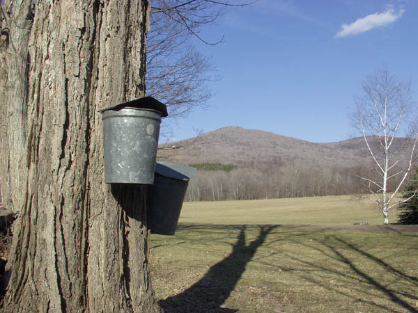
We've got some sap snow on tap. Just learned that phrase. The snow that comes down while folks are out tapping the maple trees. It's cold at night - cold enough for snow and to get the sap running.  You see the buckets hanging on trees the old fashioned way, or the tubing running through the woods to the collector bin on the side of the road.  Once I had the pleasure of hanging out in the sugar shack, eating some homemade (not box) mac and cheese, stoking the fire along the length of the long trays, adding long logs, and watching the maple syrup simmer and clouds of evaporating liquid fill the air in the barn.  It's a wonderfully relaxing experience. Conversation is small.

The daffodils and tulips are 2 inches high and will handle last night's snow easily. The robins and red-winged blackbirds are everywhere pulling fat worms out of the loosening dirt.  In late afternoon you see dozens of deer in the fields filling their bellies and delighting in the ease at which they can get food these days. Same for turkeys - the farmers are spreading their winter piles of manure and there's something for all the birds to eat. Toms are strutting their stuff - tailfeathers all fanned out - getting ready for mating season.  Quails are sitting on nests on the sides of hayfields, blending their grey, tan and brown into the spring colors. 

Muddy roads are usually when I get myself in trouble. Get going a little to fast and you pop in and out of rutts and then slide over to the ditch on the side of the road.  That's my only warning for the warming month.  Otherwise, just get out and enjoy the longer days. Take a hike, go for a leisurely bike ride. Warm up those muscles that have only shoveled snow or brought in firewood all winter.  Spring's coming back to the mountains and there'll be lots to do!!! 

April is a month usually overlooked as a fun month. But for me it's one of the ones I like best. It's the month before it gets busy - when you can still relax and just think about what you've got to do. Clean up tasks are easy and cathartic.  The pace is comfortable. So get out and enjoy your weekend house, your hayfields, plan a weekend trip chock full of relaxation.  The vibe is mellow and welcoming.

Thursday, January 20, 2011

Winter, inside and out

Catskill Scenic Trail
I popped into Lucky Dog Farm Store to pick up a sandwich for lunch the other day and met a retired couple that  I had hiked with a few years back.  Lucky for me his memory was better than mine! We had a great chat about hiking in the Catskills and about how some folks absolute LOVE for the winter season.  His body loves cold weather and is uncomfortable in the heat of the summer. I asked if he meant the heat of the summer here and laughed when he said yes.  I find summers incredibly delightful, blissfully cool in the evenings. But I did agree with him on winter. After ten years of being here full time, I have finally found the winter cold enjoyable as well.  Go figure.

What makes someone a winter person?  I'm not sure if my metabolism changed to work better in the cold or if it was more the clothes and tools!!!  Now that we have heat packs for our boots and gloves, high tech super-wicking fabric for long johns, polar fleece, balaclava's, heated handles and seats on snowmobiles and in cars, 4 wheel drive, uber-insulated boots,  there's almost nothing to worry about!!

But if you're looking for things that don't require layers of clothing, yet do provide an inside space - there are lots of fun and healthy things going on during the cold months. 

SUNY Delhi opens their aquatic center, and the mini-dome, which houses their fitness center and tennis courts, to the public during the year.  The hours can vary depending on when school is in session and student related activites - but the facilities are wonderful and a great way to work-out indoors over the winter.

The Roxbury Arts Group holds classes from Yoga to Dance throughout the winter.  Check in with them to see if anything is up and coming.  You may think the West Kortright Centre shuts down during the winter but not so..... They hold workshops too just in other locations. Check into their upcoming book binding workshop.

There are a plethora of local yoga instructors holding classes in churches or community centers - but we're at a loss for an online resource to give you. This is a word of mouth - flyer on the window of a local business - source of information, so ask around.

One of the unknown gems of the winter is the Honest Brook Music Festival's winter series.  Their once a month concerts take place in private homes so you are guaranteed an intimate environment in which to hear wonderful classical music.  

While I used to spend the winter hunkered down and safe from storms - having a great attitude about getting out and about and taking advantage of everything that local business owners and organizations do to keep us entertained and fit really does pay off in fun times and great memories.  Try some out for yourself and comment here on the results!!


Thursday, January 6, 2011

Lake Effect Snows Providing Great Backdrop for Winter Fun in the Western Catskills

The Western side of the Catskills is the first mountain range east of the Rockies that gets hit with weather systems as they cross the plains.  Not only that the Great Lakes provide just the right conditions to bring storm systems that pack a precipitation punch to the upstate region.  This translates into lots of fresh powder at area ski slopes, like Plattekill Mountain in Roxbury, NY. In last years whopper of a storm, Plattekill was tapped by the National Weather Service as receiving the most snowfall of the storm – almost 9 feet!!
Plattekill maintains its charm as a challenging mountain that is incredibly family friendly.  Double black diamond runs thrill expert skiers.  The ski school offers great instruction, a bunny hill and two side trails for easier runs.   Plattekill is open Friday-Sunday from 8:45 a.m.-4:15 p.m. Plattekill will be open for ten days straight for school break starting with the Presidents’ Weekend holiday.  Saturday nights are especially exciting with snow tubing available in two sessions, from 5-7 and 7-9 p.m. Holiday week will have additional tubing nights as well.  Check the conditions live with their mountain cam at www.plattekill.com.  New to the mountain this year is a boatload of infrastructure improvements. 
  Keeping Plattekill’s trails in peak condition is a constant effort. The mountain has almost 100 snow guns, 7,000 feet of buried snowmaking pipe, 1,000 feet of heavy electric wire (and nine electric stations) to power 2 new fan guns, a grooming machine, and new rental equipment.  A great way to understand just what it takes to get, make, and keep snow can be found on a new winter blog that features mostly Plattekill but also other winter activities in the region.  http://winterinthecatskills.blogspot.com   This blog has a little of everything from links to local teenagers terrain park videos, interviews with the snow making and grooming staff, as well as ice fishing and local village round-ups.
A number of nearby lodging facilities have partnered with Plattekill Mountain to offer money-saving packages. The most popular offering is one of their two BOGO (Buy One Get One) options. When visitors stay with a participating lodging facility, children 17 and under will receive one free lift ticket for each paid adult ticket (limit two).  Adults without children can save big too. Buy a full day lift ticket for Saturday and get Sunday’s lift ticket free.  The mountain boasts a great family cafeteria, upstairs lounge bar, child care center, fireplaces throughout and sunning benches on the deck.
If your winter adventure tastes are more leisurely, Delaware County has many fine cross-country skiing and snowshoeing options. The ideal cross-country or snowshoe route is the 26-mile rail bed known as the Catskill Scenic Trail running between Roxbury and Bloomville.  Use of the trail is free. For additional information on the rail trail, visit www.catskillscenictrail.org. All this activity is in Roxbury which boasts the award winning boutique motel, The Roxbury - check out their theme rooms at www.theroxburymotel.com. 
The Great Western Catskills Facebook page now includes a Photo of the Day section so you can remember just for real how much is on the ground, and be inspired to plan a visit. When it comes to lodging options, the Great Western Catskills features accommodations that include everything from cool and hip inns, charming bed and breakfasts, affordable and accommodating motels to private rental homes complete with fireplace and firewood. For winter lodging packages visit the getaways section of the area’s travel website at: www.greatwesterncatskills.com.

Learn more about the Western Catskills
Delaware County is located conveniently to the NYC / Albany / Rochester / Philadelphia areas for weekend getaway. For more information on travel to the Great Western Catskills visit www.greatwesterncatskills.com. For a free activity guides, art gallery and antique shop map, fishing map or event calendar, call 866-775-4425.